A public-record guide for Bel Air

What is changing at Harford Mall?

What is open, what is being demolished, what the Town has approved, and which tenants are actually confirmed.

Town phase numbers and developer project names describe the same property in different ways.

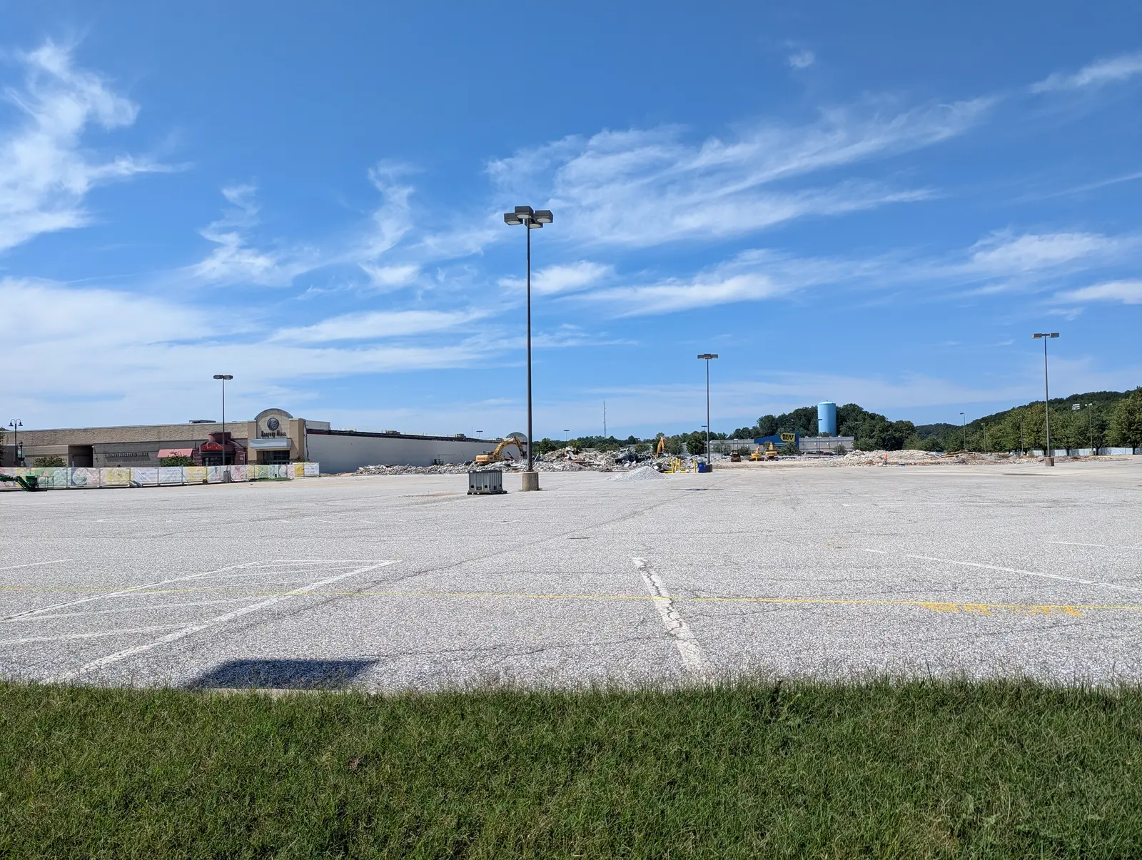
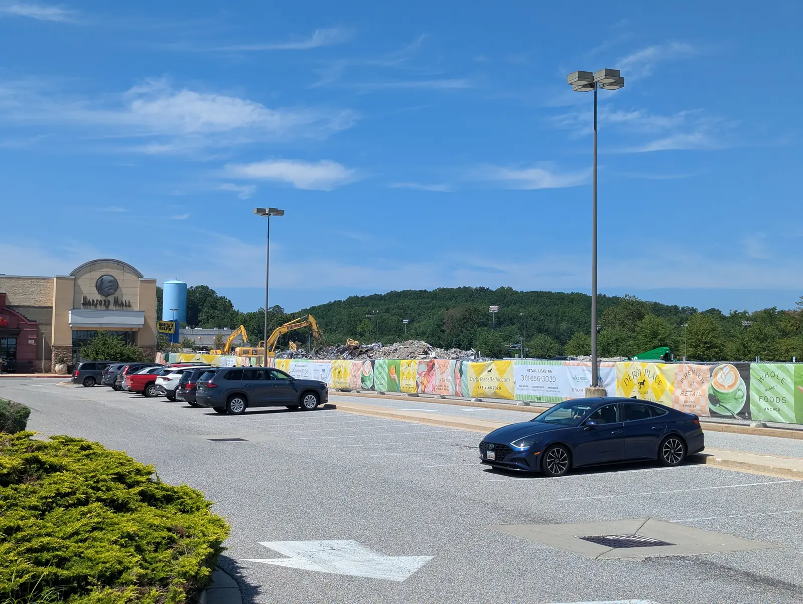
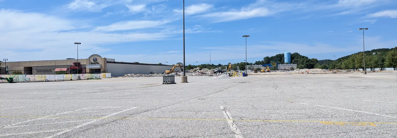
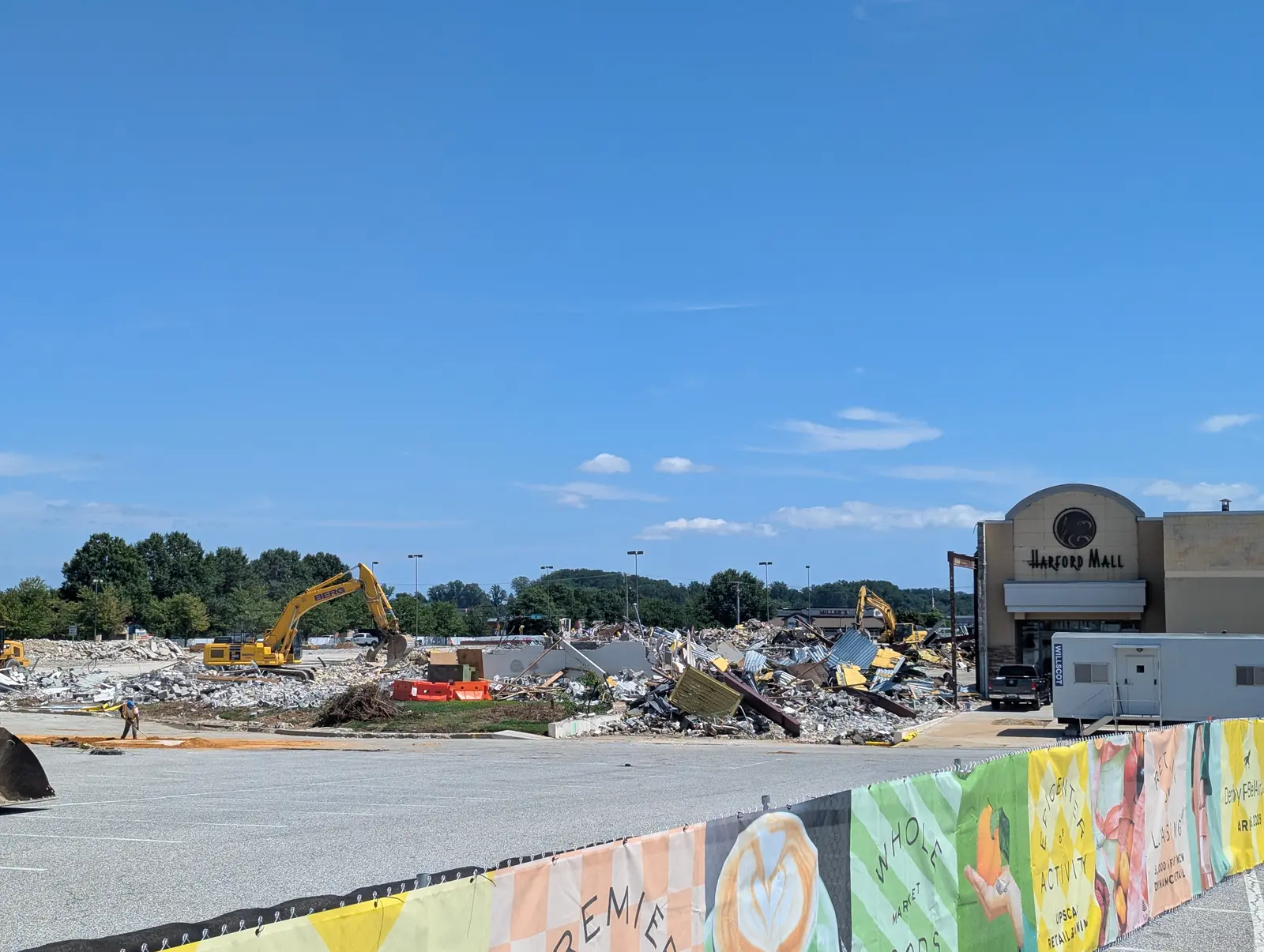
Wide east-side view across the former Macy's footprint at Harford Mall, now mostly open ground and rubble, with the retained mall at left and demolition equipment at center
The former Macy's footprint is mostly open ground and rubble, with demolition equipment still working. August 21, 2026. Photo: Scott Trice.
Demolition underway

Most of the former Macy's building has been demolished.

An August 21 field visit found most of the former Macy's building demolished. Excavators were still working through rubble and debris inside the fenced zone, so demolition and cleanup are not complete. The adjoining Harford Mall entrance and the interior mall remain standing and accessible. This matches the Town's announced sequence: disconnect the former Macy's from the rest of Harford Mall, then take the building down.

Excavators working through twisted metal and rubble beside the retained Harford Mall entrance
Excavators work through the remaining rubble beside the retained Harford Mall entrance, August 21, 2026. Photo: Scott Trice.

Redevelopment directory

Find your phase

Six Town phases, drawn from the approved site plans so the roads, the lot shape, and the buildings sit where they really are. Hover, focus, or tap a phase to light it up here and in the cards below.

Harford Mall · Bel Air, MDOriented like the Town site plans · compass shows true north
Schematic map of the six Harford Mall redevelopment phases The irregular property is framed by Veterans Memorial Highway and Maryland Route 24 at the north, Baltimore Pike and US 1 Business at the east, North Tollgate Road at the south, and bending Boulton Street at the west. Phase IV is two small outparcel pads at the northwest. Phase III, the Derby Place retail core with a grocery anchor, fills the north end. Phase II, the 249 apartments and parking garage, sits on Boulton Street below Phase IV. Phase VI, the proposed remaining interior mall concept, occupies the center beside two existing shops buildings that are staying. Phase I, Shops at Harford Mall, is at the south, with the Phase V credit union pad just east. The map also marks five traffic signals; traffic counts of 22,651 vehicles per day on Route 24, 40,801 on Baltimore Pike, and 9,330 on Boulton Street; a true-north compass; an approximate 400-foot scale; and nearby shopping centers for orientation. Veterans Memorial Hwy 22,651 veh/day MD 24 Baltimore Pike 40,801 veh/day US 1 N. Tollgate Rd S. Tollgate Rd Boulton St 9,330 veh/day Gateway Dr Best Buy · Office Depot shopping center Tollgate Marketplace III Derby Place retail core Demolition underway Grocery anchor IV IV Outparcels Approved II 249 apartments Approved Garage VI Remaining interior mall concept Proposed only Two existing shops buildings that are staying and front Baltimore Pike Existing shops Staying I Shops at Harford Mall Open V Credit union Approved N TRUE NORTH 0 200 ft 400 ft Schematic from the Town-approved site plans and recorded plat Footprints simplified · not a survey
Open Demolition underway Approved Proposed Existing, staying Traffic signal

One property, three naming systems: the Town uses Phases I through VI, the developers use names such as Shops at Harford Mall and Derby Place, and ownership parcels do not always match either label.

About the map: the road frame, lot shape, north orientation, and building positions are drawn from the SJC Ventures master plan filed with the Town, the Town phase site plans, and the recorded resubdivision plat. Shapes are simplified for reading and are not survey lines. Traffic counts come from the developer's April 23, 2026 leasing plan.

Plans and permits

Planning Department

Every entry separates what the Town has recorded from what the developer is only aiming for.

What is coming and when

Town record Developer or applicant estimate
  1. Open now
    IShops at Harford Mall

    Town recordOpen and accessible, including during the demolition next door.

  2. 2026
    IIIDerby Place retail core

    Town recordDemolition of the former Macy's underway since July 22. The Town estimated about two months of work.

  3. 2027
    II249 apartments and parking

    Town recordSite plan approval runs to January 4, 2027.

    Applicant estimate, Sept. 2025Construction start discussed for 2027.

  4. 2028
    IIIDerby Place retail core

    Developer targetSpring 2028 opening, including the grocery store.

    II249 apartments and parking

    Applicant estimate, Sept. 2025Completion discussed for 2028.

  5. No date on record
    IVDerby Place outparcels

    Approved. Waiting on final plan conditions and permit activity.

    VPoint Breeze Credit Union

    Approved. A traffic impact analysis must be approved before a building permit.

    VIRemaining interior mall concept

    Proposed. No posted online approval record found through August 21, 2026.

Solid entries come from Town of Bel Air records. Dashed entries are dates the developer or applicant has put forward, which are marketing and planning targets rather than approvals. Approval is not construction, and a target is not a commitment.

IPhase ISouth, Tollgate Rd Open

Shops at Harford Mall

The former Sears side is open as Shops at Harford Mall, fronting North Tollgate Road. The Town says its shops and restaurants remain accessible during demolition.

Next Tracker watch

Tenant and access changes while demolition runs next door.

1 canceled tenant on file

Town demolition notice
IIPhase IIWest, Boulton St Approved

249 apartments and parking

The Town-approved plan contains 249 apartments and an on-site parking deck along Boulton Street. The approval was extended to January 4, 2027. The developer's own August 5, 2026 site plan markets the same building as 250 future residences.

Next Town record

Building permit plans had not been submitted as of March 5, 2026.

Applicant estimate

A 2027 construction start and a 2028 completion, per the applicant in September 2025.

IIIPhase IIINorth, Route 24 Demolition underway

Derby Place retail core

The approved plan replaces the former Macy's and part of the mall with the main Derby Place retail area at the north end of the site, facing Veterans Memorial Highway, including a grocery store. The Planning Commission approved its site and landscape plans on January 8, 2026. Site demolition has been underway since July 22, 2026. By August 21, most of the former Macy's building had been demolished, but excavators were still working through rubble and debris.

Next Town record

Revisions to the site and landscape plans, for an increase in the size of two buildings, went before the Planning Commission on August 6, 2026.

Then Developer target

A spring 2028 opening, as the developer markets it.

5 signed tenants on file

IVPhase IVNorth tip, Boulton St Approved

Derby Place outparcels

The Town approved two additional retail buildings on the Boulton Street frontage in January 2026, subject to conditions. A revision raising the pair to 11,840 square feet, Building 400 at 6,840 and Building 500 at 5,000, went before the Planning Commission on August 6, 2026.

Next Town record

Minutes for the August 6 meeting. Staff recommended approving the revision; no minutes were posted as of August 21.

2 signed tenants on file

VPhase VSouth, Tollgate Rd Approved

Point Breeze Credit Union

The Town approved a 2,725-square-foot branch with a drive-through next to Phase I on the North Tollgate Road frontage, subject to conditions.

Next Town record

An approved traffic impact analysis, which is required before a building permit.

March 2026 minutes
VIPhase VICenter Proposed

Remaining interior mall concept

The proposal would replace much of the remaining interior mall with three buildings totaling 43,209 square feet, next to the two existing shops buildings that stay and front Baltimore Pike.

Next Record check

A posted approval record. None was found online through August 21, 2026, and the August 6 Planning Commission agenda carried no Phase VI item.
Phase VI staff report

Named tenants

Leasing Office

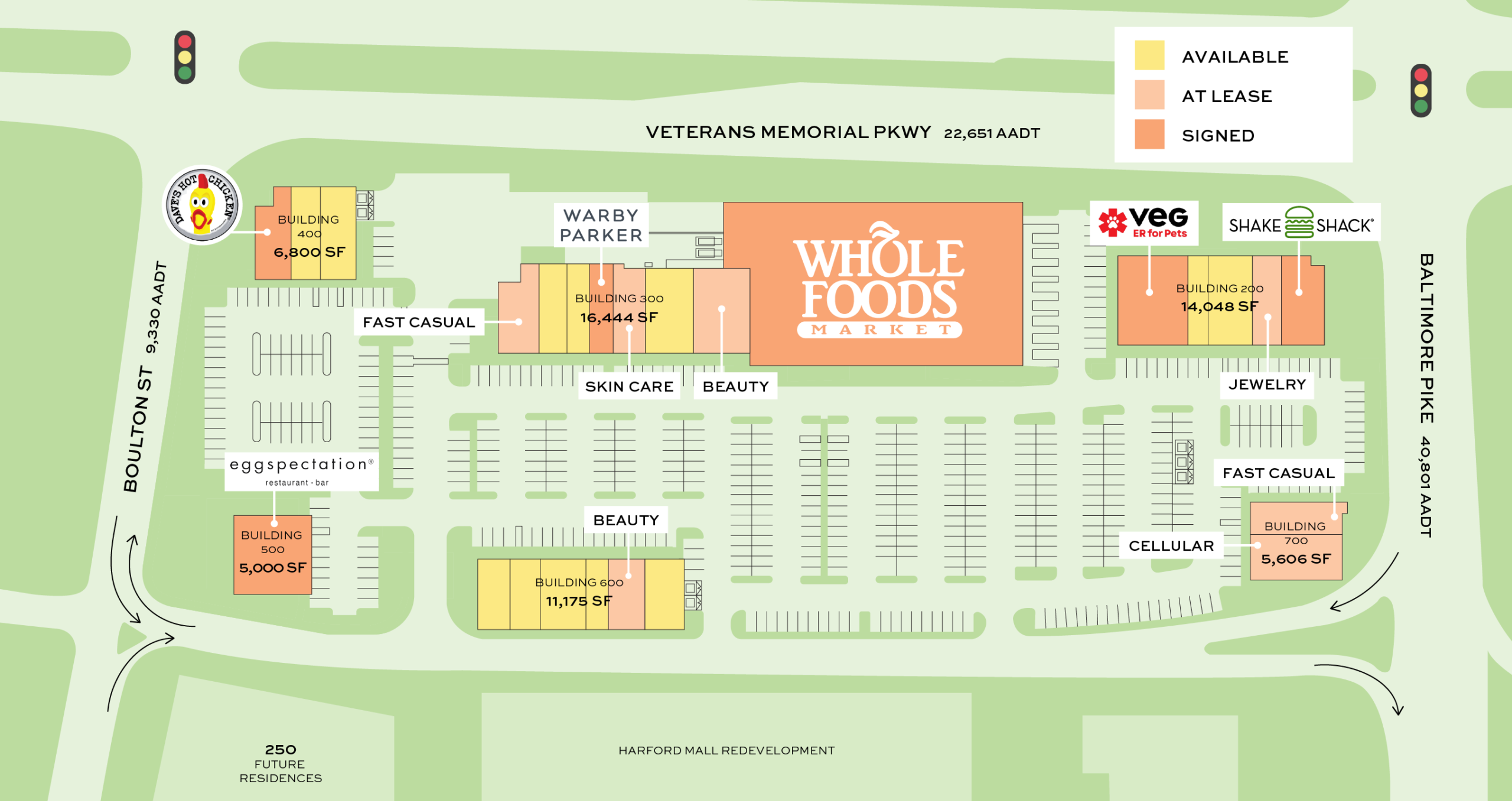
Signed means the tenant appears in current Derby Place leasing material. Announced is less certain. Canceled means an older plan did not proceed. For the tenants that came before, see the store list.

Signed Announced Canceled
Signed

Warby Parker

Added to the leasing page since the August 1 check, placed on the developer's site plan in the building west of the grocery anchor.

IIIDerby PlaceRetail core
Developer leasing

Newest first

Newsstand

Developer dates stay labeled as targets, never as schedule.

  1. Field observation

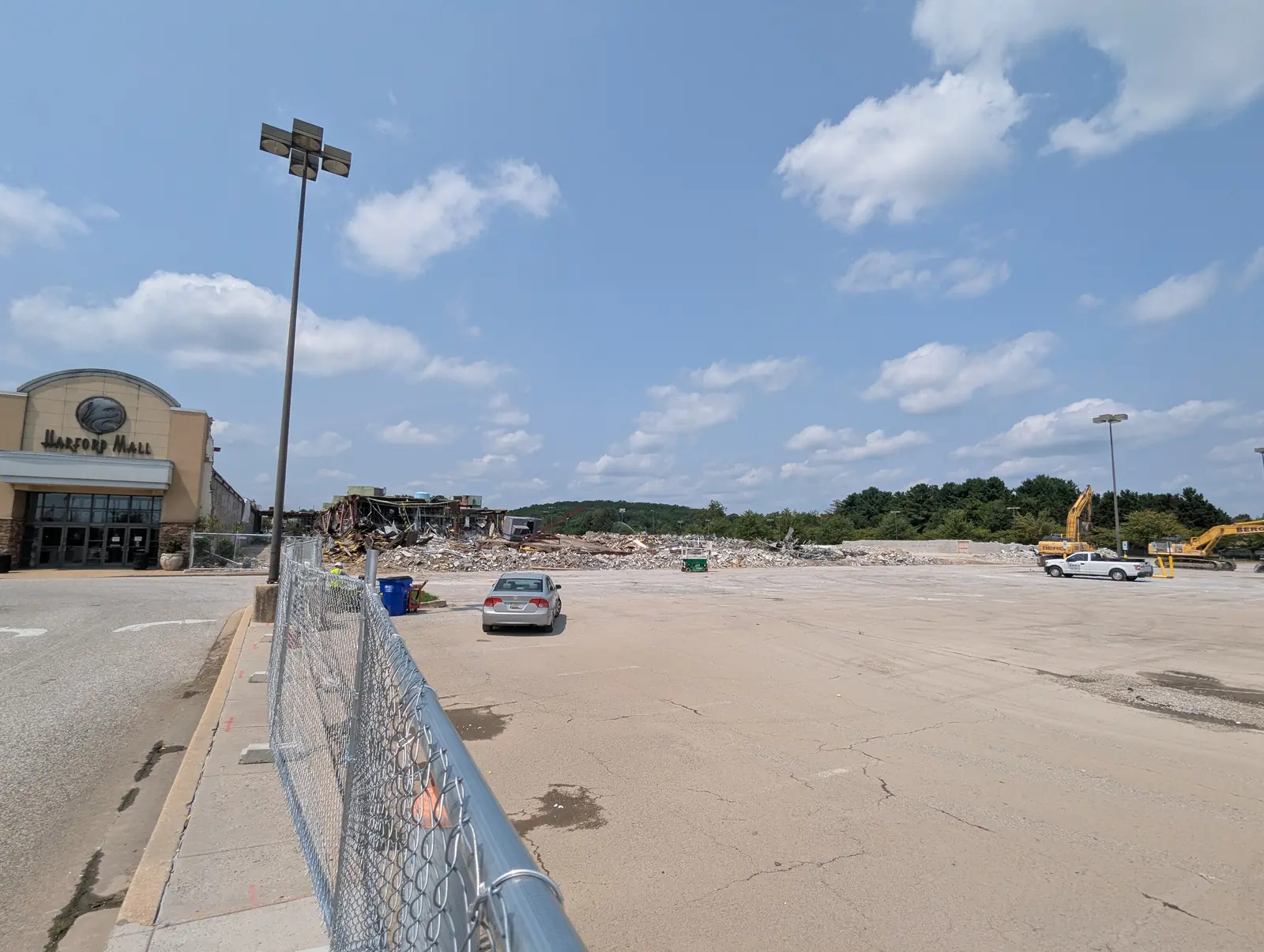
    Most of the former Macy's building has been demolished. Excavators remain active among rubble and debris, so demolition and cleanup are still underway beside the retained Harford Mall entrance.

  2. Field observation

    Most of the former Macy's footprint is cleared. The retained Harford Mall entrance and surviving interior mall now stand at the exposed edge of the demolition zone, with rubble and a smaller section of structure remaining.

  3. Leasing update

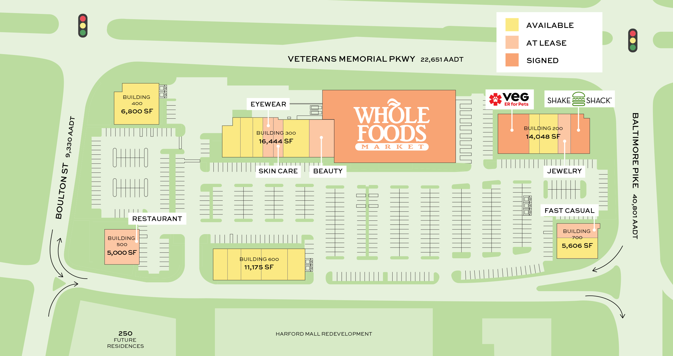
    The current SJC Ventures site plan lists Gloss Nail Bar in suite 630, bringing the Derby Place tenant list shown there to seven.

    Source: SJC Ventures project page
  4. Leasing update

    Dave's Hot Chicken and Warby Parker appear in the Derby Place leasing material, and Eggspectation, previously only announced, now appears there too. The developer posts a site plan dated August 5 marking which spaces are signed.

    Source: Derby Place leasing
  5. Before the Commission

    Revisions to the Phase III and Phase IV site and landscape plans go before the Planning Commission, raising the two Phase IV buildings to 11,840 square feet and increasing the size of two Phase III buildings. Staff recommended approval. No minutes were posted as of August 21.

    Source: Planning Commission staff report
  6. Field observation

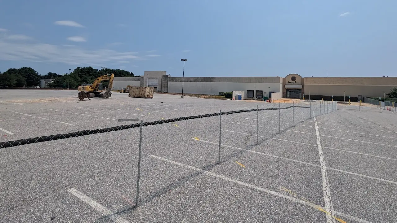
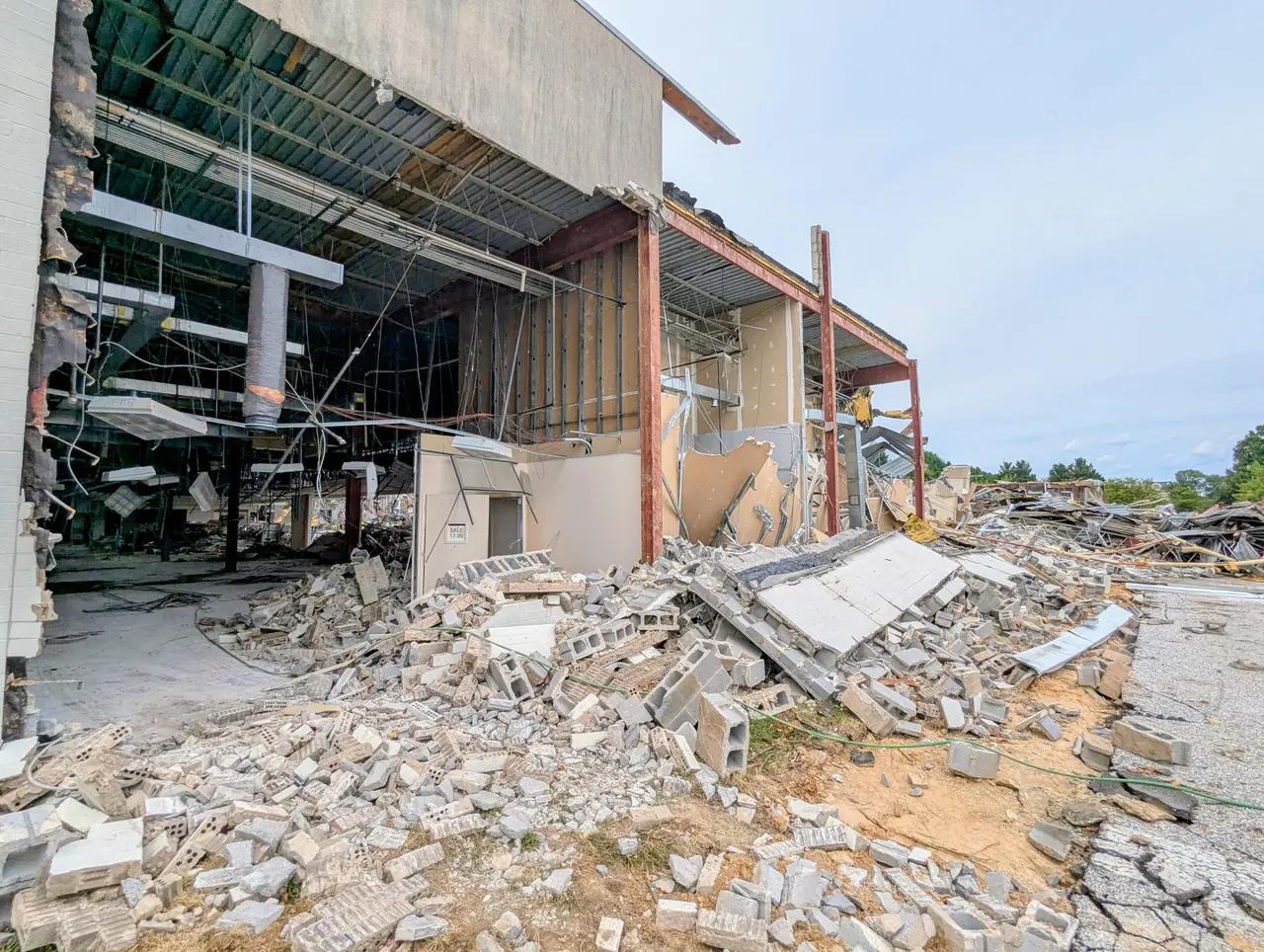
    The former Macy's east side is torn open, with structural steel, roof decking, and interior partitions exposed above a fresh rubble pile. The north side remains fenced and staged, unchanged since July 26.

  7. Field observation

    The former Macy's work zone is fully fenced with equipment on site. No major exterior structural demolition is visible from the parking area.

  8. Field report

    Site demolition activity is underway; sidewalk rubble is reported at the former Macy's site.

    Source: WMAR-2 News
  9. Schedule update

    The Town revises its notice: demolition is expected to begin July 22.

    Source: Town of Bel Air
  10. Field report

    Construction fencing appears around the former Macy's.

    Source: CBS News Baltimore
  11. Official notice

    The Town posts demolition logistics and confirms the rest of the mall remains accessible.

    Source: Town of Bel Air
  12. Proposed

    Phase VI appears before the Planning Commission. No posted online approval record was found as of the August 21 check.

    Source: Development proposals
  13. Approved

    Phase V and revised Phase II architecture receive approvals with conditions.

    Source: Planning Commission minutes
  14. Approved

    Phase III and Phase IV receive site plan and landscape plan approval with conditions.

    Source: Planning Commission minutes
  15. Approved

    Phase III receives conditional approval.

    Source: Planning Commission minutes

Getting around

Customer Service

What remains open, what is fenced, and which traffic conditions still stand between an approval and a building permit. The store list marks which individual stores are still trading.

Mall remains open

Access during demolition

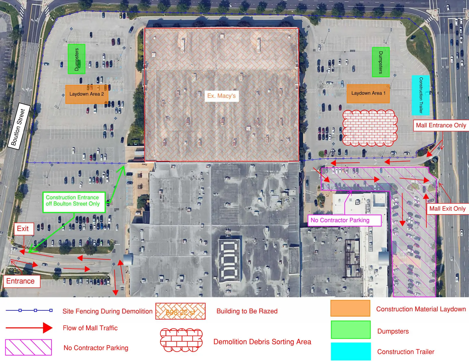
  • The former Macy's parking areas in front and behind the building are fenced off.
  • The Town says the remaining mall shops and restaurants will stay accessible.
  • The demolition notice estimated about two months of work.
  • Phase V still requires an approved traffic impact analysis before a building permit.

See the Town's demolition logistics notice

Harford Mall · 696A Bel Air Rd., Bel Air, MD 21014View larger map

Direct links

Records Room

Town records control approvals and unit counts. Current developer material controls branding, leasing claims, renderings, and target dates.

  1. 01
    Town development proposalsCurrent packets and meeting materials
    Open source
  2. 02
    SJC Ventures master planFiled in the Town's January 2026 Phase IV packet
    Open PDF
  3. 03
    Town overall phase site planHarford Mall Phase VI, May 4, 2026
    Open PDF
  4. 04
    Phase III and IV resubdivision platFourth resubdivision plat, January 30, 2026
    Open PDF
  5. 05
    Derby Place leasing planDeveloper plan with AADT traffic counts, April 23, 2026
    Open image
  6. 06
    Derby Place site planDeveloper plan marking signed, at-lease and available space, August 5, 2026
    Open image
  7. 07
    Former Macy's demolition noticeTown of Bel Air, June 30, 2026
    Open source
  8. 08
    Phase III approval minutesPlanning Commission, July 17, 2025
    Open PDF
  9. 09
    Phase IV approval minutesPlanning Commission, January 8, 2026
    Open PDF
  10. 10
    Phase II and V approval minutesPlanning Commission, March 5, 2026
    Open PDF
  11. 11
    Phase VI staff reportPrepared May 28, 2026
    Open PDF
  12. 12
    Derby Place retail leasingCurrent developer branding, tenants, and target dates
    Open source
  13. 13
    July 22 demolition field reportWMAR-2 News, July 22, 2026
    Open source
  14. 14
    July 13 fencing field reportCBS News Baltimore, July 13, 2026
    Open source
  15. 15
    Eggspectation announcement reportPatch, June 26, 2026
    Open source
  16. 16
    Phase III and IV revision staff reportPlanning Commission, prepared July 28 for the August 6, 2026 meeting
    Open PDF
  17. 17
    Amazon Fresh cancellation reportWBAL-TV, June 5, 2026
    Open source
  18. 18
    SJC Ventures Derby Place project pageCurrent developer site plan, leasing brochure, and contacts
    Open source

Two reels

Photo Booth

See what is there now, how the demolition zone is laid out, and what Derby Place is supposed to become.

Fenced former Macy's work zone at Harford Mall with an excavator and the exterior building still standing

Fenced and staged

Equipment and fencing were in place July 26, on the north side, which still looked like this as of August 1.

Photo: Scott Trice, July 26, 2026
Exposed steel framing, roofing, and rubble at the former Macy's east side at Harford Mall

Exposed structure

Steel framing, roof decking, and interior partitions are exposed above a fresh rubble pile on the east side.

Photo: Scott Trice, August 1, 2026
East-side view across the cleared former Macy's footprint at Harford Mall, with the retained mall entrance at left

The Macy's footprint opens up

The retained Harford Mall entrance stands at left; most of the former Macy's footprint is now open ground and rubble.

Photo: Scott Trice, August 13, 2026
East-side view across the former Macy's footprint, now mostly open ground and rubble, with the retained Harford Mall at left

Most of the building is down

The wide view shows open ground and low rubble across most of the former Macy's footprint, with demolition equipment still working.

Photo: Scott Trice, August 21, 2026
Excavators working through twisted metal and rubble beside the retained Harford Mall entrance

Rubble work continues

Excavators work through twisted metal and debris immediately beside the retained mall entrance.

Photo: Scott Trice, August 21, 2026
Southeast view of the open Harford Mall entrance, Derby Place construction fence, demolition equipment, and rubble

Open mall, active work zone

The southeast view places the operating mall beside the fenced Derby Place demolition area.

Photo: Scott Trice, August 21, 2026
Town of Bel Air demolition logistics image for the former Macy's at Harford Mall

Work zone

The Town's notice marks the former Macy's demolition area and the access expected to remain open.

Source: Town of Bel Air, June 30, 2026
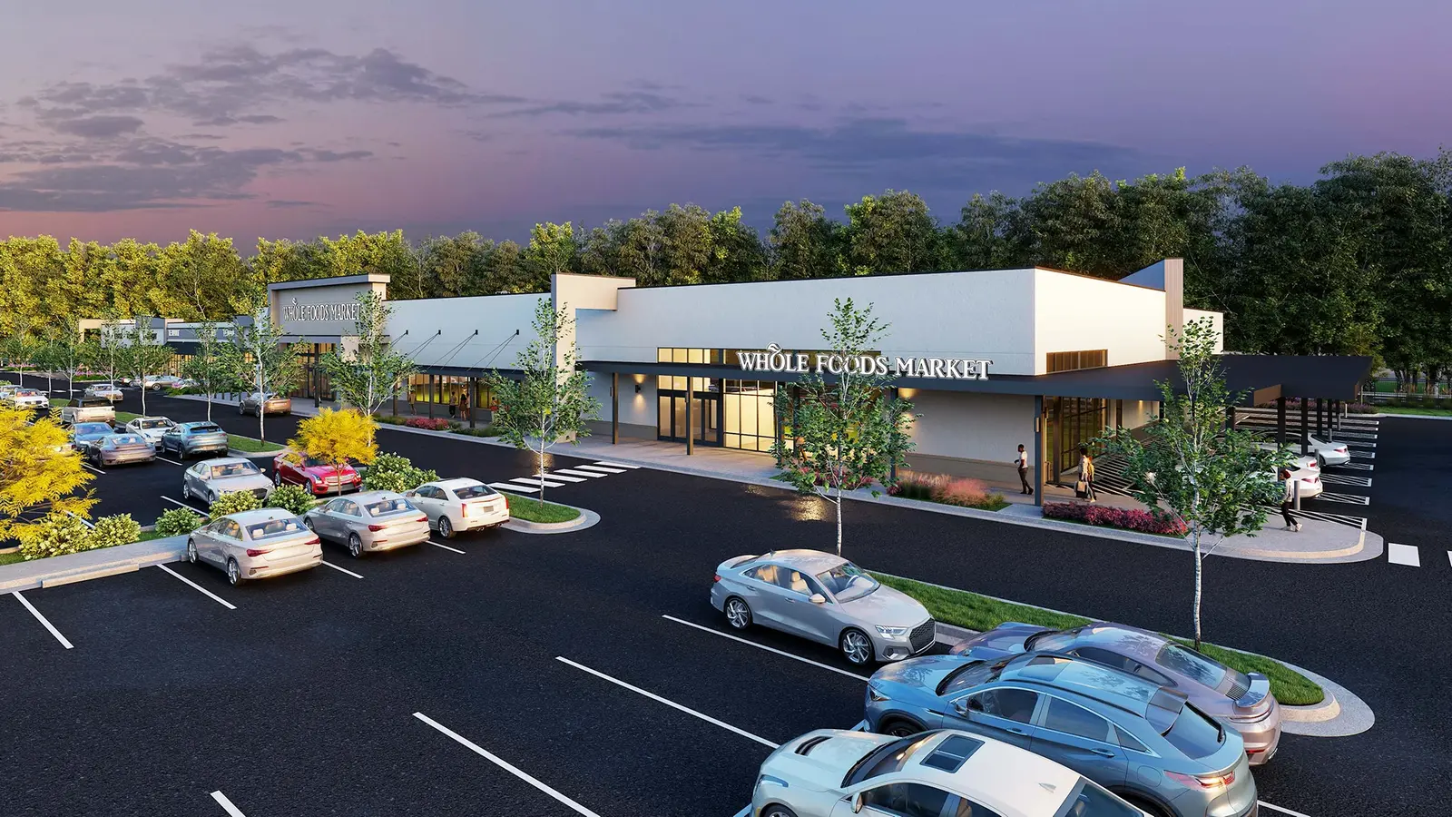
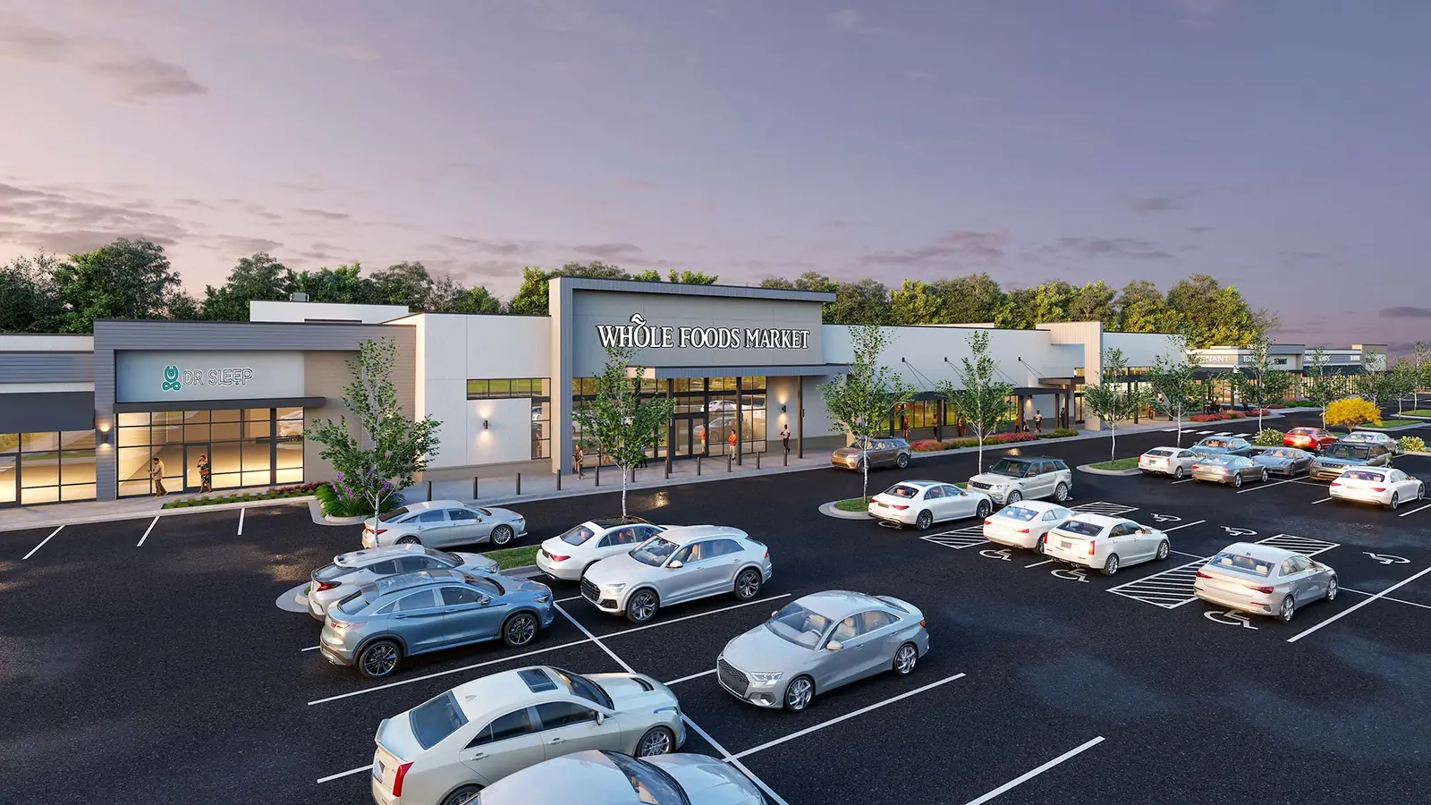
Developer rendering of the planned Derby Place retail development

Whole Foods approach

The rendering shows the developer's concept for the grocery anchor and adjoining retail.

Source: Derby Place, developer rendering
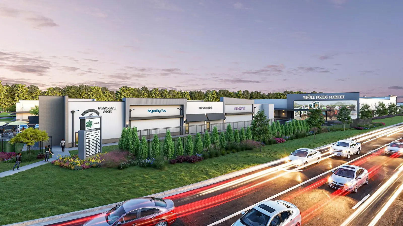
Developer rendering of the planned landscaped roadside edge of Derby Place behind the retail buildings

Roadside edge

A second view shows the developer's concept for the landscaped edge behind the retail buildings.

Source: Derby Place, developer rendering
Developer rendering of the planned Whole Foods storefront and adjoining Derby Place retail facing the parking area

Retail frontage

This view faces the Whole Foods storefront and adjoining retail from the planned parking area.

Source: Derby Place, developer rendering